Navionics+ Charts

145.00210.00 ex. VAT 19%

Clear

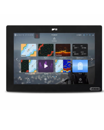
Transform the way you navigate with fully-featured vector charts, dynamic raster charts.
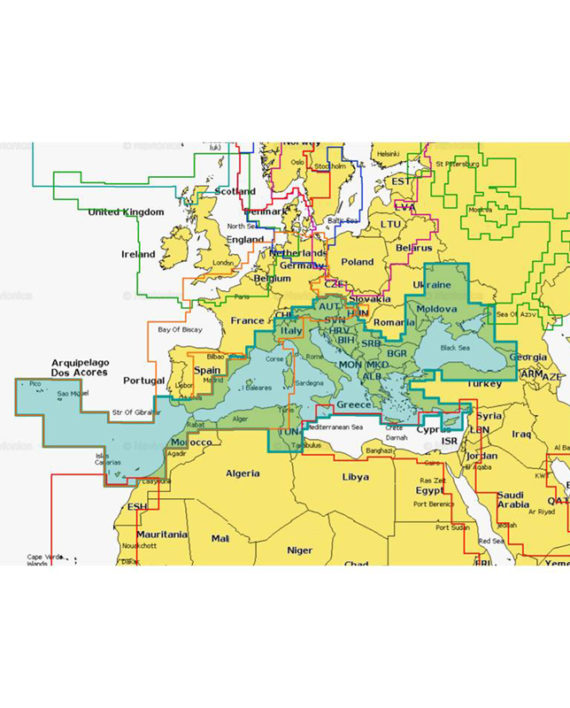
Navionics Charts

Boat safer and savor every moment on the water! All-in-one max detailed cartography for marine and lakes makes Navionics+ the perfect choice for cruising, sailing and fishing.

Get the most accurate navigational data, an exclusive 0.5 m HD bathymetry map which is enhanced by boaters like you, and unique local content shared by Navionics app users.

Daily updates and advanced features are included for one year.

Power in your hands

The most accurate and thorough set of information created for marine and lakes. All essential cartographic reference detail for cruising, sailing and fishing: port plans, safety depth contours, marine services, tides & currents, and navigation aids.


Ordering Information

Navionics +

Regular

Part Number Coverage Price excl. VAT
010-C1320-30/ITP Mediterranean Sea, Southeast € 145,00
010-C1319-30/ITP Aegean Sea, Sea of Marmara € 145,00
010-C1308-30/ITP The Gulf & Red Sea € 145,00

Large

Part Number Coverage Price excl. VAT
010-C1351-40/ITP Mediterranean & Black Sea € 300,00
010-C1307-40/ITP Africa & Middle East € 300,00

Specifications

Sonar Chart

High Def 1 ft/0.5 m detail

SonarChart is an HD bathymetry map featuring extraordinary bottom contour detail, great for increasing awareness of shallow waters and for locating fishing areas at any depth level. See video.

Community Edits

Local inputs, great benefit

Thanks to millions of Navionics app users who are continuously on the water, all kinds of valuable local information is constantly enhanced such as seasonal buoys, lights, rocks, moorings, boat ramps, and points of interest like restaurants and provisioning shops.

Daily updates

The most current charts every day
Only Navionics customers can enjoy this unique benefit: the most current charts every time they go boating. Have a new Navionics card? Get one year of daily updates when you register your card online within 2 months of product purchase. The Navionics Boating app also offers daily updates for one year.

Dock-to-dock Autorouting

A unique breakthrough
All autorouting existing today can find a route from A to B only if they are both in open water, while good guidance and planning is most needed in cramped complex waterways with a maze of variables. A unique breakthrough in boating navigation, Navionics Dock-to-dock Autorouting, instead, quickly calculates a detailed route even through narrow passages and channels, based on chart data and navigation aids.

SonarChart™ Live

Create your own maps
SonarChart Live allows you to create new personal 1 ft/0.5 m HD bathymetry maps that display in real time while navigating. The feature can be enabled by connecting wirelessly to a sonar from your mobile that has a Navionics Boating app installed. Alternatively, it can be displayed directly on the screen of compatible plotters.